Whaleback Falls
!
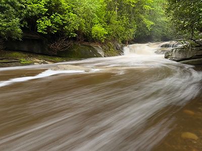
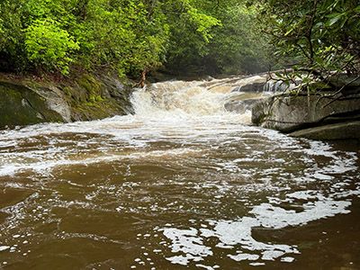
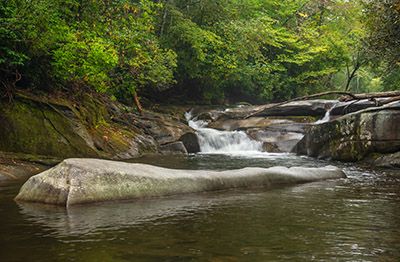
Whaleback Falls won’t win any awards in a region full of beautiful waterfalls, but the short walk makes it a good choice if you’re already in the area and can handle the steep climb down the bank. The trailhead is the same as the Cove Creek Falls hike, so you could easily visit Whaleback on the same outing. The large pool below the falls is a great spot to cool off on hot summer day.
Whaleback Falls with the whale's back in the foregraound. (023I-256899)
Driving Directions
Open driving directions in map appFrom the junction of US 64, US 276, and NC 280 in Pisgah Forest, near Brevard, drive north on US 276 for 5.25 miles and turn left on FS 475. Drive 3.1 miles on FS 475 to the parking area on the left, just before the road crosses Cove Creek. You’ll see a sign for Cove Creek Group Camp.
Hiking Directions
Start on the gravel path on the same side of the road as the parking area. The path follows Cove Creek downstream to Davidson River. Near the river, the path splits; go either way and in a few feet you’ll come to a campsite. The waterfall is right here but hidden by trees. Walk 50 feet from the campsite and take the scramble path down to the river. This part is a little dicey for some people.
| Accessibility: | Hiking trail |
| County: | Transylvania |
| River Basin: | French Broad |
| Watercourse: | Davidson River |
| Watershed: | Medium |
| Type and Height: | 8-foot-high cascading falls into large pool Height measured with rangefinder. |
| Landowner: | Pisgah NF, Pisgah RD |
| Beauty Rating: | 3 |
| Elevation: | 2539 feet |
| USGS Map: | Shining Rock |
| Hike Difficulty: | Easy/Moderate+ Most of the hike is easy, but scrambling down the bank to the river is tough. |
| Hike Distance: | A little over 100 yards |
| Waterfall GPS: | 35.28212, -82.816638 |
| Trailhead GPS: | 35.28302, -82.81684 |
Photo Gallery
Click a photo to enlarge.