
William O. Huske Lock and Dam Number 3
!
One of three locks on the Cape Fear above Wilmington, and the most upstream, William O. Huske Lock and Dam can be safely ignored without fear of missing something. The only reason I can think that you would enjoy visiting it is if you just happen to be nearby and need a picnic table, or if you are weirdly attracted to river navigational locks.
You can’t see the dam without getting in the water and the whole place is ugly. I do recommend seeing Lock and Dam Number 2 and Number 3 downstream, especially Number 1.
The three locks and dams on Cape Fear River were constructed between 1915 and 1935 to provide a navigable channel for commercial vessels between Wilmington to Fayetteville. The locks were regularly used for many years, but river commerce slowly declined and they are no longer needed for commercial transport. In fact, I don’t believe they are currently operating for any vessels. The locks have been considered for removal for several years, but it’s a complicated issue as Number 2 and Number 3 are used as water supply intakes, and there are other concerns involved.
For information about Cape Fear River in general, including a table listing all the waterfalls on the river, visit the River Basins & Rivers page and click on the Cape Fear River Basin tab.
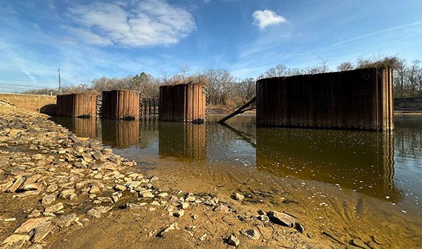
Back there somewhere is the dam, but this is all you can see without getting out in the water. (014Z27_269975)
Driving Directions
From U.S. Army Corps of Engineers website:
William O. Huske Lock and Dam #3 is located at Tolars Landing, approximately 17 miles south-southeast of Fayetteville, NC. Wm. O. Huske lock and dam is accessible to public use via connecting road SR 1355 to North Carolina State Road 87.
1248 Bill Hall Road
Fayetteville, North Carolina 28306
Hiking Directions
Quick Glance
You can walk down to the river, but you can’t see anything of the dam and nothing interesting of the locks. Just a bunch of ugly steel and concrete.
Detailed Look
No details needed.
| Accessibility: | Roadside view |
| County: | Bladen |
| River Basin: | Cape Fear |
| Watercourse: | Cape Fear River |
| Watershed: | Amazon |
| Type and Height: | — |
| Landowner: | U.S. Army Corps of Engineers |
| Experience Rating: | Meh |
| Elevation: | — |
| USGS Map: | — |
| Hike Difficulty: | View roadside |
| Hike Distance: | — |
| Waterfall GPS: | 34.834249, -78.823866 Measurement taken from informational kiosk in the parking area. |
| Parking GPS: | — |