Allens Falls
!
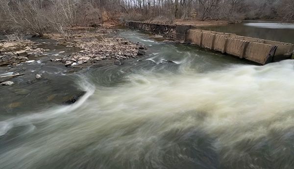
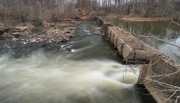
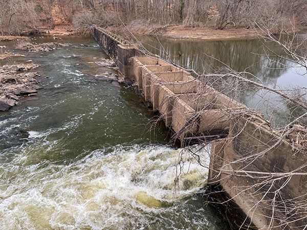
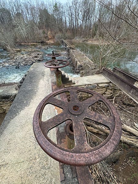
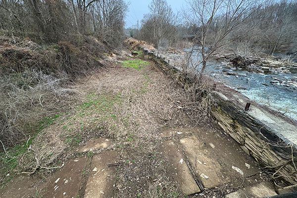
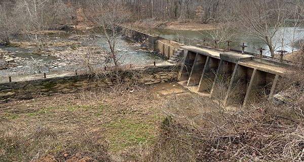
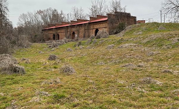
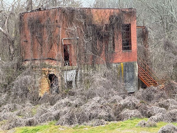
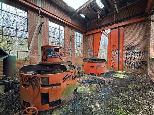
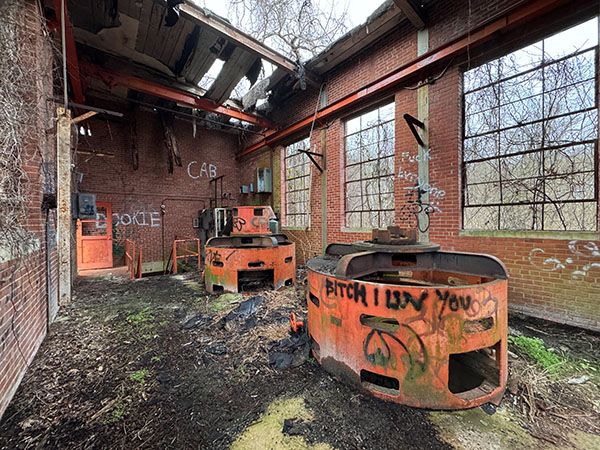
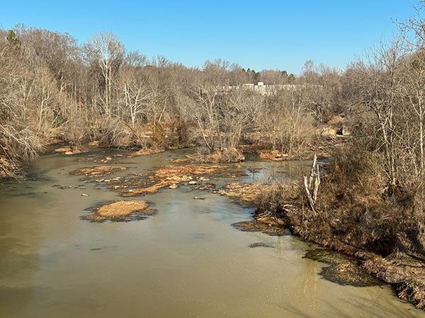
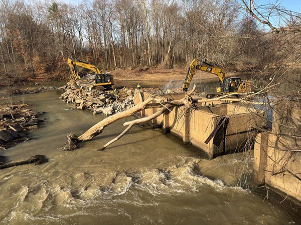
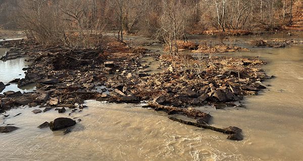
Allens Falls is a set of rapids upstream from the Brooklyn Avenue bridge in Ramseur. A small dam just above the rapids was removed in January 2026. Downstream are the ruins of the old cotton mill that utilized the dam for generating mechanical hydropower and later hydroelectricity. Downstream from the old power plant is Allen Shoal, which I haven't been able to locate precisely.
The town of Ramseur and several project partners are developing the area around Allens Falls as a public park, with a section of Deep River State Trail located here. Hopefully, the work will include preserving the remaining historic structures of the cotton mill.
For information about Deep River in general, including a table listing all the waterfalls on the river, visit the River Basins & Rivers page and click on the Cape Fear River Basin tab.
(027H-269443)
Driving Directions
Open driving directions in map appThe trailhead is at the corner of Liberty Street and Depot Street in Ramseur. A chain crosses the access path here.
A new trailhead and crosswalk is being constructed on the other side of Brooklyn Avenue at the old cotton mill site.
Hiking Directions
Quick Glance
Follow the path beyond the chain.
Detailed Look
You’ll be able to see where the dam was removed. Downstream from there, you can see lots of rocks in the riverbed, which I assume is Allens Falls.
| Accessibility: | Forest road |
| County: | Randolph |
| River Basin: | Cape Fear |
| Watercourse: | Deep River |
| Watershed: | Large |
| Type and Height: | Small river rapids |
| Landowner: | Unique Places to Save and town of Ramseur I’m not sure which one owns the property or if they own it as a partnership. |
| Experience Rating: | Fair |
| Elevation: | — |
| USGS Map: | Ramseur |
| Hike Difficulty: | Easy |
| Hike Distance: | A little over 100 yards |
| Waterfall GPS: | 35.73188, -79.6569 |
| Trailhead GPS: | 35.732182, -79.655528 A new trailhead is being constructed at the old cotton mill site. |
Photo Gallery
Click a photo to enlarge.