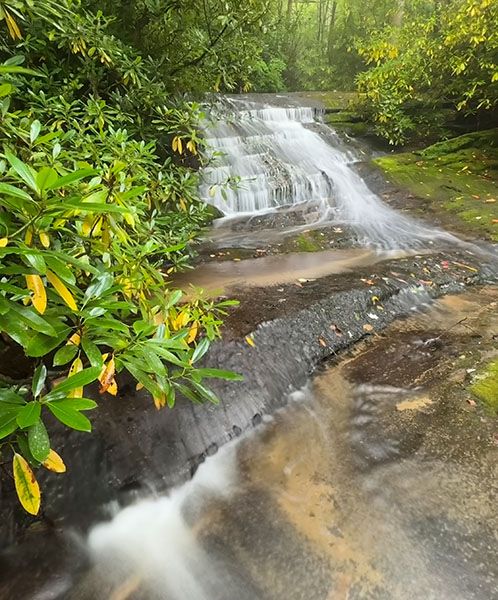
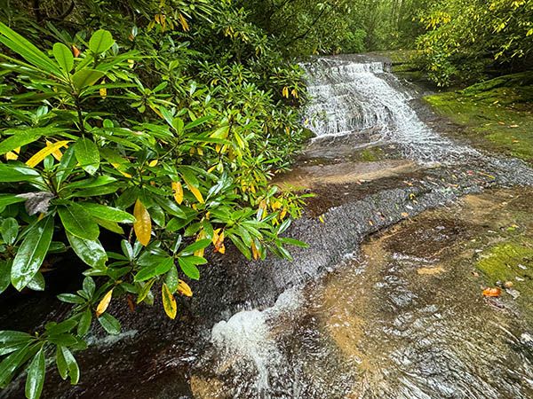
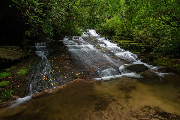
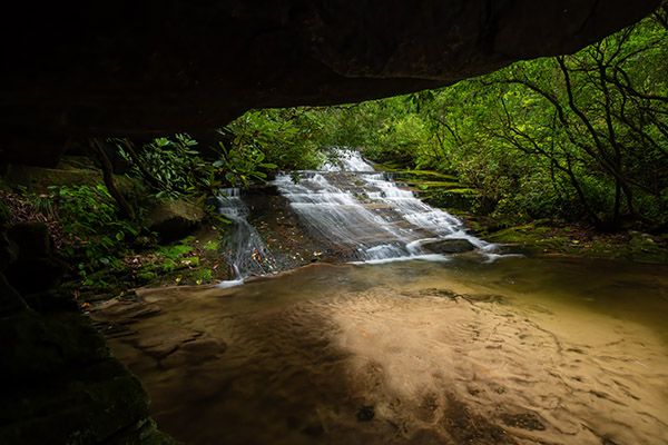
Christmas Falls
!
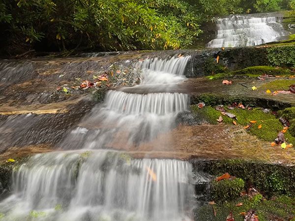
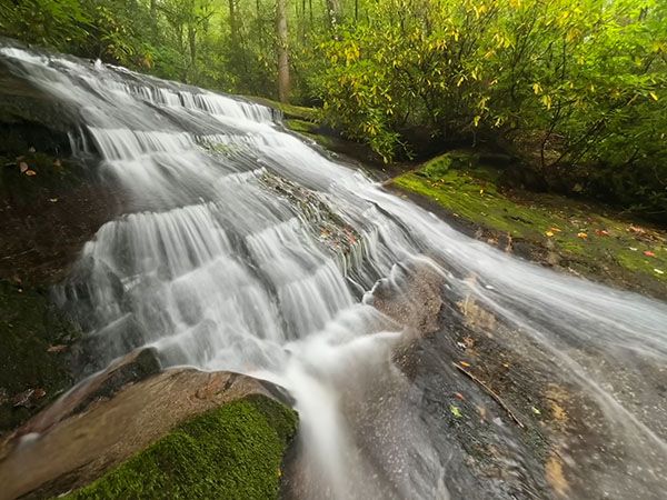
Christmas Falls is a very short distance downstream from Merry Falls in DuPont State Recreational Forest. The waterfall part is not as nice as Merry, but it has a cool rock overhanging the pool.
(030L-257056)
Driving Directions
Open driving directions in map appFrom Cedar Mountain on US 276, south of Brevard, turn on Cascade Lake Road at the sign for DuPont State Recreational Forest. Drive 2.5 miles to where Staton Road turns right. Don’t turn; continue straight on Cascade Lake Road, which soon becomes unpaved, 1.9 miles to a small pullout, on the left. You’ll pass Merry Falls right before reaching the pullout.
Hiking Directions
Quick Glance
If you try to get there quick, you’ll get hurt. Read the detailed description.
Detailed Look
A faint but discernable path starts from the upper end of the pullout and winds a little over 100 feet to small bluff overlooking the pool below the falls. To the right is a dicey path descending to the creek. Best bet here is to bushwhack through the woods to get around this part. You’ll need to wade upstream a few yards to reach a good view of the falls. Try not to bump your head on the rock overhang. (I was told that could happen.)
You can also reach the falls by creekwalking a few hundred feet downstream from Merry Falls. It’s an easy trek for those with creekwalking experience. To view the falls from the base, you’ll need to climb down the river-left side of the falls, which is also not too bad.
Regardless of the route you take, this one is best left to experienced bushwhackers and creekwalkers.
| Accessibility: | Bushwhack or creekwalk |
| County: | Transylvania |
| River Basin: | French Broad |
| Watercourse: | East Fork Laurel Creek |
| Watershed: | Small |
| Type and Height: | Sliding and cascading falls about 26 feet high Height estimated from LiDAR map. |
| Landowner: | DuPont State Recreational Forest |
| Beauty Rating: | 4 |
| Elevation: | 2350 feet |
| USGS Map: | Brevard NC/SC |
| Hike Difficulty: | Difficult |
| Hike Distance: | A few hundred feet |
| Waterfall GPS: | 35.201912, -82.643682 |
| Trailhead GPS: | 35.201996, -82.643156 |
Photo Gallery
Click a photo to enlarge.