
Fishtop Falls
Fishstop FallsHammer FactorFish Top Falls
!
After the Green River flows through The Narrows and before its waters make it to Green River Cove Road, it plunges over Fishtop Falls, a Class V rapid in a picturesque part of the river. It’s not something you’ll regard as a true waterfall, but it’s scenic and relatively easy to reach. If you’re in the area visiting Milton Bradley Falls, Fishtop Falls makes a good side trip.
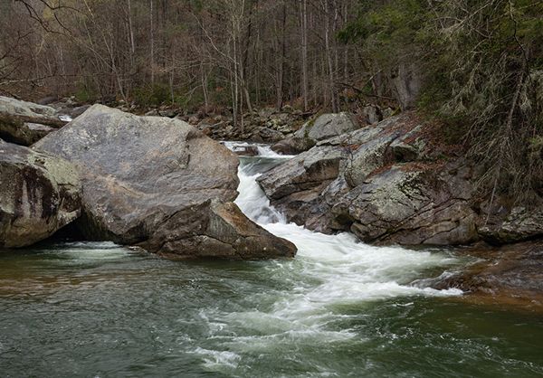
Fishtop Falls. (002G-212371)
Driving Directions
Open driving directions in map app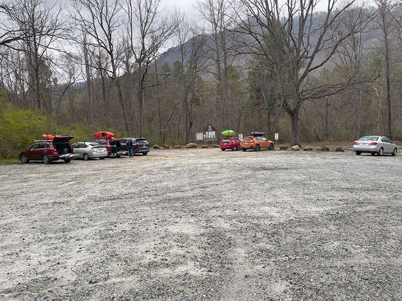
Trailhead for Fishtop Falls. (002G-212484)
Take the Saluda exit (Exit 59) off I-26 and head east on Holbert Cove Road (SR 1142). After less than 0.1 miles, turn left on the curviest paved road in North Carolina, Green River Cove Road (SR 1151). Drive 2.4 miles to the large Fishtop Access Area on the left. Park here.
Hiking Directions
Quick Glance
Take the path to the left of the kiosk and work your way upstream to the falls.
Detailed Look
Begin at the kiosk and cross a small stream in a few yards. (Easy rockhop in normal flows.) In less than 100 yards from the stream, you’ll come to a fork, with the more obvious path going along the river. The easier route is probably to the left. That route ascends moderately for a couple hundred yards, then descend 50 yards to rejoin the path along the river. Now you must squeeze between rhododendron and a boulder, and then descend to the river. Fishtop Falls is about 100 yards farther upstream.
| Accessibility: | Hiking trail |
| County: | Polk |
| River Basin: | Broad |
| Watercourse: | Green River |
| Watershed: | Medium/large |
| Type and Height: | Class V rapid |
| Landowner: | Green River Game Land |
| Beauty Rating: | 2 |
| Elevation: | 1060 feet |
| USGS Map: | Cliffield Mountain |
| Hike Difficulty: | Moderate Class I bushwhack |
| Hike Distance: | About a quarter mile |
| Waterfall GPS: | 35.266489, -82.328004 Reading from about 75 feet downstream. |
| Trailhead GPS: | 35.264007, -82.324722 |