Kiesee Falls
!
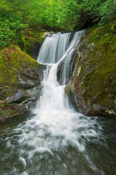
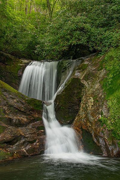
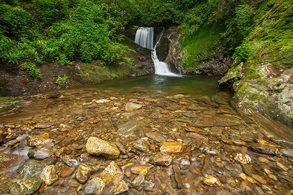
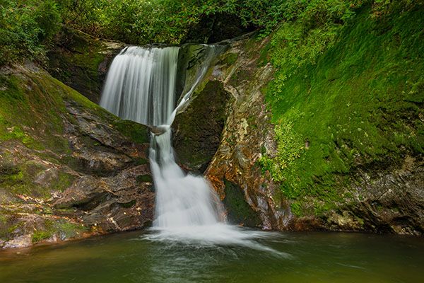
Kiesee Falls descends in two sections over water-sculpted rock. The upper section has carved out a large pothole. The plunge pool is an inviting swimming hole, the perfect spot to cool off after a summer hike along the overgrown trail.
Upper Kiesee Falls is only a couple hundred feet upstream, but because of the steep rock walls surrounding Kiesee Falls, you can’t get to it safely from here. It may be possible to climb the rock on river right, but I don’t recommend it. Even if you make it up safely, you’ll likely destroy a lot of vegetation doing so.
(022D-163952)
Driving Directions
Open driving directions in map appFrom Beech Gap on Blue Ridge Parkway, drive 6.65 miles south on NC 215 and turn left on the gravel FS 140 (Courthouse Creek Road). FS 140 is 10.4 miles north of US 64. Follow the road for 2.3 miles to a sharp left turn and park here. This is 0.2 miles before reaching the gate and the trailhead for Courthouse Falls and Chestnut Falls.
Note that as of this writing, FS 140 is closed indefinitely. If it is closed when you visit you’ll have to park in the area beside NC 215, across from FS 140, and walk the road.
Hiking Directions
Quick Glance
Sorry, can’t make this one quick.
Detailed Look
At my last visit in August 2020, logging was occurring on the uphill slopes at the trailhead and areas of flagging tape that I suspect were associated with the logging were in the uncut woods along the hike. I wrote these directions right after this hike, the logging activity could have caused them to be inaccurate. Also, things could have changed now that the forest has began recovery.
An obvious road created by logging bulldozers starts from the curve in FR 140. Follow this road through the logged area and into the uncut woods. Once you leave the logged area the road is overgrown somewhat, but easily followed.
The road forks at 0.26 miles (35.27402, -82.88442). Go right on the lower path. At 0.48 miles the road forks again. To the left is the route to upper Kiesee Falls. For Kiesee Falls, take the overgrown but recognizable logging road bearing right (35.27670, -82.884426). The road leads about 0.15 miles down to Kiesee Creek. It is heavily overgrown and suffers from downfall, so it will be difficult to navigate but you should be able to follow it okay.
When you reach the creek, you’ll have to scramble down the back, which could be a little tricky. Cross the creek to the river-left side and hike upstream through dense dog hobble for a couple hundred feet. You’ll come to a small falls with a deep pool hemmed in by a steep rock slope. At this point, it’s only a short distance to Kiesee Falls, but to get there, you’ll have to climb the bank, then negotiate a steep, exposed rockface back down to the creek. The final stretch is a short creek walk up to the falls.
| Accessibility: | Hiking trail and bushwhack |
| County: | Transylvania |
| River Basin: | French Broad |
| Watercourse: | Kiesee Creek |
| Watershed: | Small |
| Type and Height: | Two-section drop totaling about 18 feet Height estimated. |
| Landowner: | Pisgah NF, Pisgah RD |
| Beauty Rating: | 6 |
| Elevation: | 3480 feet |
| USGS Map: | Sam Knob |
| Hike Difficulty: | Difficult |
| Hike Distance: | About 0.7 miles |
| Waterfall GPS: | 35.27935, -82.88205 |
| Trailhead GPS: | 35.27126, -82.88205 |
Photo Gallery
Click a photo to enlarge.