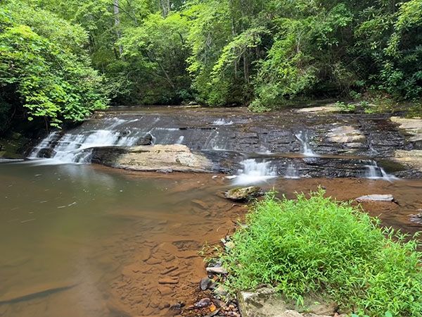
Middle waterfall on Grassy Creek
!
See the listing for Upper waterfall on Grassy Creek for a little more detail into my thoughts about the waterfalls on this creek. Suffice it to say that despite the low beauty rating, I believe there is merit in visiting these waterfalls.
The Directions provide details for reaching all three waterfalls on the creek, as well as Klondike Lake Dam.
Middle waterfall on Grassy Creek. (122E2-256888)
Driving Directions
Open driving directions in map appThe trailhead is located at Grassy Creek Vineyard & Winery, 235 Chatham Cottage Ln, State Road, NC 28786.
Hiking Directions
I’m providing directions here for all three waterfalls on Grassy Creek, as well as Klondike Lake Dam.
Quick Glance for the middle waterfall on Grassy Creek
Hike Grassy Creek Vineyard Trail/Forest Bathing Trail to a fork. Turn left, walk a short distance, and turn right on Cascade Loop Trail. The upper waterfall is a short distance farther. The middle waterfall is 100 yards downstream from the upper falls.
Detailed Look for all waterfalls and Klondike Lake Dam
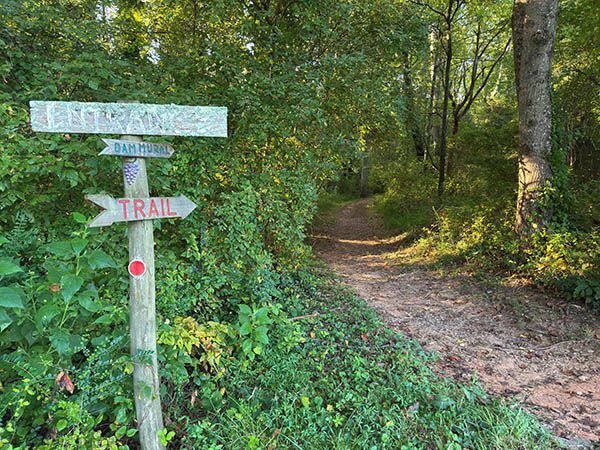
Sign at trailhead. (122E2-266649)
The trailhead is the same for the waterfalls and the dam. If you’re facing the winery, it’s to the left, across the drive, at the edge of the woods by the trail kiosk.
The first 0.2 miles is both Grassy Creek Vineyard Trail and Forest Bathing Trail. It descends gradually to a fork. Go right for the dam, left for the waterfalls.
If hiking to the falls, go left from the fork and follow Chapel Spur Trail less than 100 yards to another fork. Cascade Loop Trail turns right and follows along the creek less than 0.1 miles before reconnecting with Chapel Spur Trail. The quickest route to the upper and middle waterfalls is along this trail. On it, you’ll come to the upper waterfall in a short distance.
The trail passes right beside some smaller cascades downstream from the main falls. For the best view of the main section, you must walk up the creekbank a short distance.
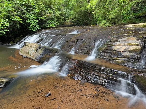
Back on Cascade Loop Trail and hiking downstream, it’s about 100 yards to the middle waterfall. A stick ladder takes you down the bank to the falls.
For the lower waterfall, continue Cascade Loop Trail a short distance to Chapel Spur Trail and turn right. The trail kinda ends at the top of the lower falls. There is no good view from here, and this is the end of the Chapel Spur Trail easement, so you can’t legally go farther downstream.
Now back at the junction with Chapel Spur Trail and the trail to Klondike Lake Dam. Grassy Creek Vineyard Trail and Forest Bathing Trail follow the creek upstream a little over 100 yards to a footbridge over Grassy Creek. On the other side of the creek, Grassy Creek Vineyard Trail turns left. (It connects with Mountains-to-Sea Trail, which goes to Carter Falls.)
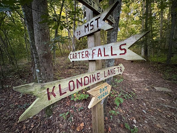
Trail sign on the way to the dam. (122C-266648)
For Klondike Lake Dam, go straight on the combination Forest Bathing Trail and Klondike Lake Trail. In less than 0.1 miles, you’ll come to the start of the loop portion of Forest Bathing Trail. You can go either way, but if you just want to get to the dam the quickest way, continue straight, following the creek upstream. After hiking about 0.1 miles, you’ll come to a fork. To the right, it’s about 200 feet down to the overlook of the dam. To the left, it's about 0.8 miles back to the start of the loop.
It's hard to miss the Forest Bathing Trail sign at the start of the loop. It invites the hiker to “Take the opportunity to disconnect from technology. Turn off your phone. Put your ear plugs in your pocket.”
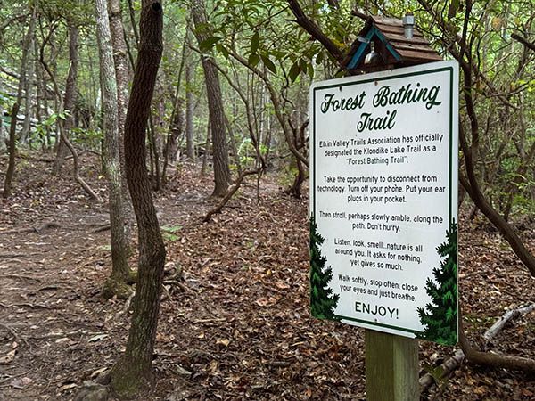
(122C-266638)
Great advice for any trail! But on this one, you might want to leave the ear plugs in when you get away from the creek so they drown out the constant drone of tires whining and mufflers rumbling on US 21. I hear there is an effort underway to rename this trail “Irony Trail.”
Just kidding!
| Accessibility: | Hiking trail |
| County: | Surry |
| River Basin: | Yadkin-Pee Dee |
| Watercourse: | Grassy Creek |
| Watershed: | Very small |
| Type and Height: | 6-foot cascading falls |
| Landowner: | Private, accessible to the public Elkin Valley Trails Association has an easement for the trail to the waterfall. |
| Beauty Rating: | 1 |
| Elevation: | 1055 feet |
| USGS Map: | Elkin North |
| Hike Difficulty: | Easy/moderate |
| Hike Distance: | A little over 0.3 miles |
| Waterfall GPS: | 36.290438, -80.861454 |
| Trailhead GPS: | 36.294292, -80.861855 |
Photo Gallery
Click a photo to enlarge.