Paradise Falls

Anvil Horn Falls
!
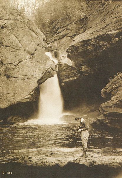
Here, East Fork Tuckasegee River cuts through a tight slot canyon, dropping about 45 feet through sculpted rock into a pool before spilling another 18 feet over a broad open face. A massive cliff, more than 100 feet high, rises over the falls.
There’s a lot going on with this waterfall—access issues, name confusion, and more. Click Show More for the full story.
Not far upstream are two more waterfalls, Second Falls and First Falls. Both are on private property, with no public access.
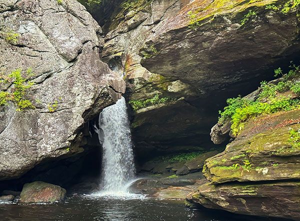
The main upper section of Paradise Falls, a.k.a. Anvil Horn Falls. See the horn of the anvil? (105O-276019)
Driving Directions
Open driving directions in map appTanasee Creek Access Area is located at 14280 Canada Road (NC 281) in Tuckasegee.
Hiking Directions
Quick Glance
Paddle down the Tanasee Creek arm of the lake, then turn up the East Fork Tuckasegee arm toward the falls.
Detailed Look
The only practical legal way to see any part of Paradise Falls is by starting on a boat. You could walk the lakeshore when the water is low, as it often is, but you’d be dealing with miserable bushwhacks around the lakeside cliffs. You could also approach from the west through Nantahala National Forest on old logging roads and bushwhacks, but that makes little sense when the lake route is shorter and easier.
A 30-minute paddle brings you to the large boulders that block travel farther up the river. If the lake is full, you may be able to climb over them. Bring about 30 feet of rope so you can tie off your boat. Once past the boulders, walk a short distance upstream to the falls.
If the lake is drawn down much, you probably won’t be able to climb over the rocks unless you’re a rock climber. Beach your boat at the small earth dam on river left, just before the rocks. From the top of the dam, enter the woods on an old road, follow it briefly, then turn left onto another old road. After a short distance, leave the road and head toward the falls.
Both old roads are overgrown and can be hard to follow, but they help some. Use a map app to keep yourself aimed at the falls. Don’t drop to the river too early or you’ll run into small cliffs; you need to reach the river very near the base of the falls.
The sandy beach you’re aiming for is at 35.209579, -82.998128.
Remember, the base of the falls provides a limited view. Climb higher to see the upper portion, and you’ll very likely be trespassing.
| Accessibility: | Boat trip and short hike in reverbed |
| County: | Jackson |
| River Basin: | Little Tennessee |
| Watercourse: | East Fork Tuckasegee River |
| Watershed: | Medium |
| Type and Height: | Mostly freefalling drop through narrow chasm and a lower drop over open rock face; total height approx. 65 feet Height measured with rangefinder. |
| Landowner: | Duke Energy & Private |
| Beauty Rating: | 7 |
| Elevation: | 3160 feet |
| USGS Map: | Lake Toxaway |
| Hike Difficulty: | Difficult |
| Hike Distance: | Approx. 1.25 miles |
| Waterfall GPS: | 35.209652, -82.997654 |
| Trailhead GPS: | 35.216357, -82.987729 This is for Tanasee Creek Lake Access Area. |
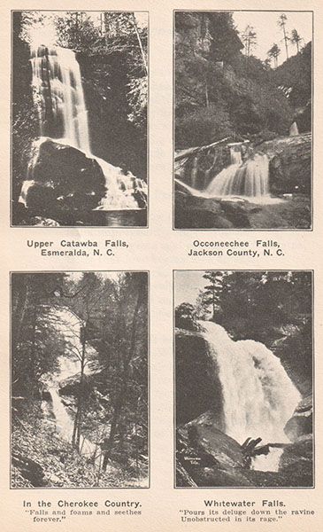
Historical Gallery
Click a photo to enlarge.