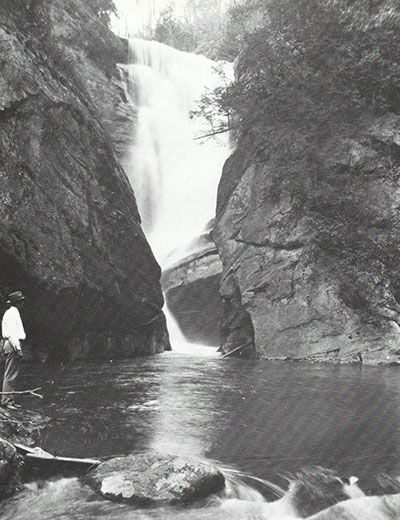
Wolf Creek Falls

!
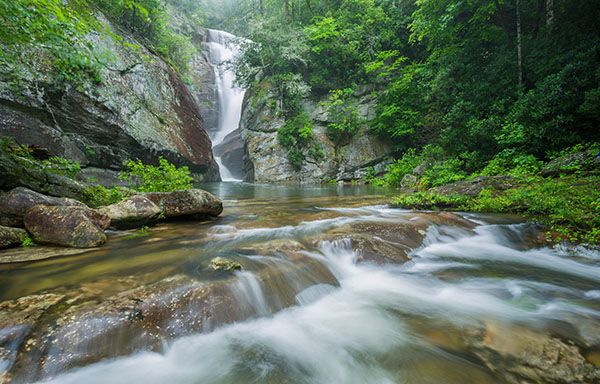
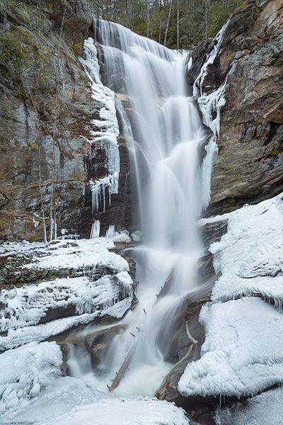
Beauty, dramatic geology, name confusion, real danger, a college hangout atmosphere, and signs warning of possible nudity all make Wolf Creek Falls one of North Carolina’s more unusual and intriguing waterfalls.
It’s a popular hangout and swimming spot for Western Carolina University students. Visit on a weekend while classes are in session, and you’ll likely find people spread across the rocks, swimming in the pools, and—alarmingly—jumping from the high cliff above the lower plunge pool.
Wolf Creek Dam, about half a mile upstream, controls the flow over the falls. Most of the time, there’s enough water for a decent view, but the falls can also run nearly dry. During larger Duke Energy releases, the waterfall is especially impressive. If the water is too high, though, crossing the creek to reach the river-left view may not be safe.
From the base of Wolf Creek Falls, you can look downstream and see the brink of Wolf Creek F1.
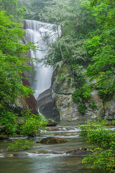
Wolf Creek Falls. (105A-57899)
Driving Directions
Open driving directions in map appFrom the US 64/NC 281 junction east of Lake Toxaway, drive north on NC 281 for 12.7 miles to a large pullout on the left. You’ll pass Tanasee Creek Lake and cross Wolf Creek Dam. The pullout is 0.4 mile beyond the dam. Coming from the other direction, it is 12.4 miles from NC 107.
The trailhead is the same for Wolf Creek F1.
Hiking Directions
Quick Glance
Can’t make this one quick.
Detailed Look
TOP AND BASE OF FALLS
Two trails descend from the parking area to the falls. One starts near the middle of the lot, and the other begins at the lower west end, near the road.
The middle trail is probably the quickest and easiest way to reach the base; the lower trail is slightly faster for reaching the top. The two routes meet near the falls, so you can visit both spots without returning to the trailhead.
The middle trail drops steeply to a T. Turn right to connect with the trail from the lower end of the parking area, or turn left to descend to the creek. Near the creek, another trail turns left and heads upstream, passing a cool rock shelter before winding along an ungraded path to a nondescript spot on the creek.
Where the main trail reaches the creek, cross over and pick up the trail on the far side. It climbs to a ridge. To reach the base of the falls, cross the ridge and make the very steep descent to the pool below.
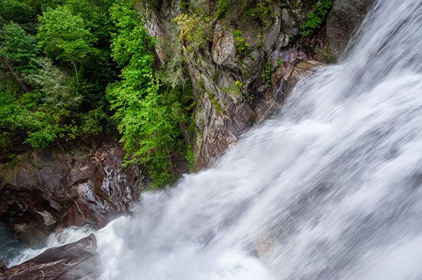
If you stay on the ridge spine, the path soon drops left and descends to the creek at the top of the falls. This area is dangerous.
From the top of the falls, you can follow a path upstream a short distance, then cross over to join the trail from the lower end of the parking area. The climb is very steep and leads to a T; turn right. You’ll soon cross a landslide area, then pass the connector to the middle trail just before reaching the trailhead.
RIVER-RIGHT VIEW OF FALLS
Few visitors see the waterfall from this side, but it’s worth the effort if you can reach it safely. From here, you get an open, frontal view of the main drop, plus a profile view from beneath the massive cliff. The catch is the approach: it’s difficult and dangerous, and only hikers with solid off-trail experience should attempt it.
There are two routes. From the downstream end of the lower plunge pool, a river-right path climbs the cliff—the route used by people heading to the jump-off spot. It continues past that point to the frontal view, then works around beneath the cliff to the profile view.
The frontal view is at the top of a steep sloping rock that’s tempting to climb down instead of swinging around it. Be careful here, especially when it’s wet.
For the second route, start on the trail from the lower end of the parking area. After crossing the landslide and reaching the left-hand path that drops to the creek, continue straight a few yards to the ridge spine. Years ago, a fairly obvious path followed the ridge, but it’s now badly overgrown. Stay on the ridge until you find a clearer path dropping off the left side. It descends to the base of the cliff, which you can follow to the falls view.
If you choose this route, be comfortable with difficult off-trail travel and know how to navigate with a map app.
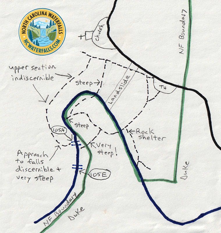
I drew this sketch after an October 2024 visit. It’s fairly close to scale, but the paths aren’t drawn precisely.
| Accessibility: | Hiking trail & slope scramble |
| County: | Jackson |
| River Basin: | Little Tennessee |
| Watercourse: | Wolf Creek |
| Watershed: | Medium Flow is dam controlled. |
| Type and Height: | Mostly freefalling waterfall approx. 121 feet high Height estimated from LiDAR map, including the small upper falls. The part visible from the base measures 105 feet using rangefinder. |
| Landowner: | Nantahala NF, Nantahala RD |
| Beauty Rating: | 9 |
| Elevation: | 2800 feet |
| USGS Map: | Big Ridge |
| Hike Difficulty: | Difficult |
| Hike Distance: | About 0.4 miles |
| Waterfall GPS: | 35.223942, -83.005533 |
| Trailhead GPS: | 35.225495, -83.003492 |
Photo Gallery
Click a photo to enlarge.
Historical Gallery
Click a photo to enlarge.