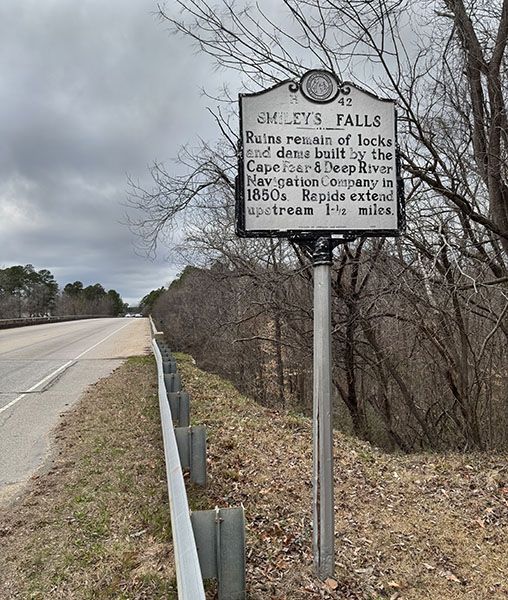
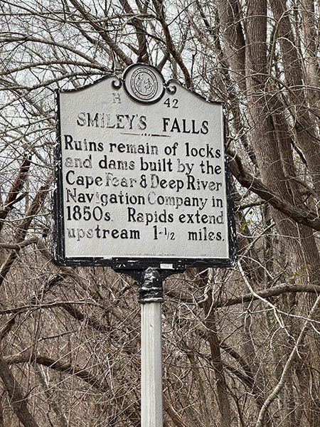
Smileys Falls
Killing FallsCampbells FallsSmilies FallsSmylies Falls
!
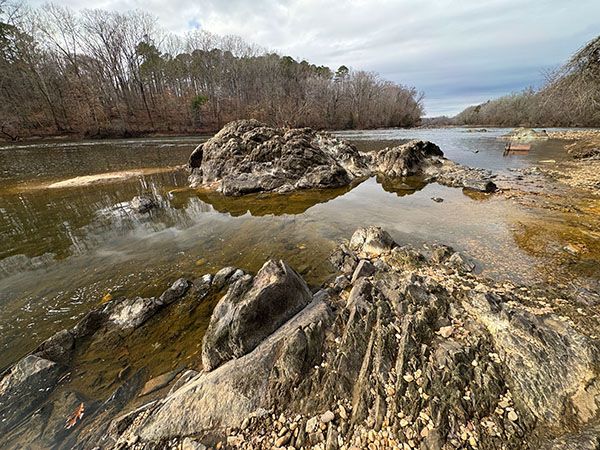
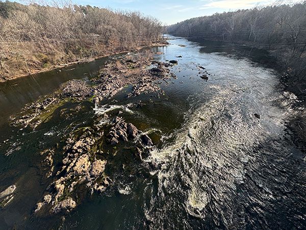
Smileys Falls is just a rapid, as is the case with all named waterfalls on Cape Fear River. But Smileys is a little different in that this rapid extends for over 2 miles! One account says it’s 3.5 miles (see the excerpt under Power Generation). My measurement, based on historical accounts stating the beginning and end of the falls, is approximately 2.4 miles. Either way, this makes Smileys Falls the longest named waterfall in North Carolina, though it’s worth noting that the rapids are not continuous. There’s a lot of flat water along that 2.4-mile stretch of river.
An interesting aspect of Smileys Falls is that it’s a collective name for several separately named waterfalls and other features that don’t carry waterfall names. At the head is Narrow Gap, where the river is constrained through a narrow channel as it flows around Big Island. Downstream is Killing Falls and finally, Campbells Falls, below the NC 217 bridge.
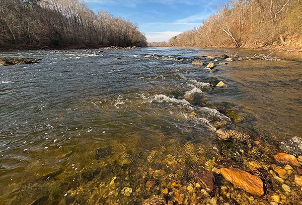
One thing I especially like about Smileys Falls is that it is somewhat accessible to everyone. Cape Fear River Trail Park, at NC 217 in Erwin, provides access to the river, and while you can’t see some of the more prominent rapids in the Smileys Falls complex from there, you do get marginal access to Campbells Falls and some nice river scenery.
For information about Cape Fear River in general, including a table listing all the waterfalls on the river, visit the River Basins & Rivers page and click on the Cape Fear River Basin tab.
(014C-269349)
Driving Directions
Open driving directions in map appThe trailhead is the same as Nameless waterfall at Cape Fear River Trail Park. Cape Fear River Trail Park is on the river-left side of the river at the NC 217 bridge. The address is 1002 S. 13th Street, Erwin.
Hiking Directions
Quick Glance
Near the parking area are several overlooks and a path that leads down to the river. Click here for a map.
Detailed Look
Right at the parking area is a wide path that leads down to the boat access. From there, there is an unofficial path continuing downstream to the NC 217 bridge. From under the bridge, you can see Campbells Falls on the far side of the river.
Upstream from the boat access are winding paths and overlooks but no official trails going down to the river. The best river view requires scrambling down the steep bank from Overlook 3. To reach it, follow the path 0.2 miles from the parking area upstream to the factory building. Walk the path behind the building for 0.15 miles to the Dunn-Erwin Rail-Trail, which turns right. Stay with the river, continuing straight, and reach the overlook in less than 0.1 miles. A few yards ahead, behind the fence, is Nameless waterfall at Cape Fear River Trail Park in the small canyon.
There is a makeshift path to the left of the overlook. It descends steeply to Cape Fear River. Upstream a few yards is a nice view of the river and the mouth of the canyon with the waterfall. To see it, follow the little stream for a short distance upstream.
| Accessibility: | Hiking paths and bank scramble |
| County: | Harnett |
| River Basin: | Cape Fear |
| Watercourse: | Cape Fear River |
| Watershed: | Amazon |
| Type and Height: | Very long series of rapids |
| Landowner: | Harnett County Harnett County owns the river-left side at the park. Property farther upstream and on the river-right side is private. |
| Experience Rating: | Good |
| Elevation: | — |
| USGS Map: | Erwin |
| Hike Difficulty: | Easy/difficult |
| Hike Distance: | About half a mile Half mile to farthest upstream river view. There are other views close to the parking area. |
| Waterfall GPS: | 35.3283738, -78.700097 Location is the approximate midpoint of the falls. |
| Trailhead GPS: | 35.3135, -78.691332 |
Photo Gallery
Click a photo to enlarge.