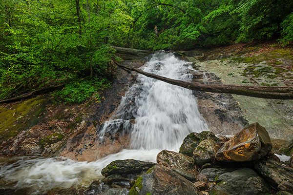
Upper Courthouse Falls
!
Upper Courthouse Falls probably isn’t on the radar of the multitudes of people who visit Courthouse Falls, but those who are comfortable with a little scrambling will find it to be a rewarding adventure. And you are pretty much guaranteed to have it all to yourself.
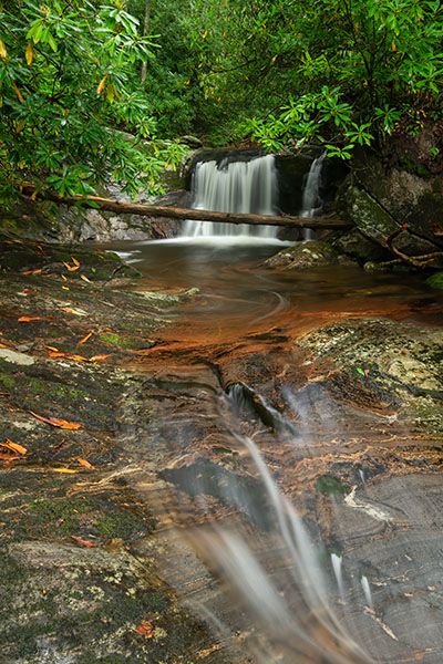
The lower section. (022K-252481)
Driving Directions
Open driving directions in map appThe trailhead is the same as the waterfalls on Chestnut Creek, Cody Falls, Courthouse Falls, and red Rock Falls. From Beech Gap on Blue Ridge Parkway, drive 6.65 miles south on NC 215 and turn left on the gravel FS 140 (Courthouse Creek Road). FS 140 is 10.4 miles north of US 64. Follow the road for 2.5 miles to the gate and park in the cleared area on the left. This trailhead is 0.2 miles farther on FS 140 than the trailhead for Kiesee Falls and Upper Kiesee Falls.
Note that as of this writing, FS 140 is closed indefinitely. If it is closed when you visit you’ll have to park in the area beside NC 215, across from FS 140, and walk the road.
Hiking Directions
Quick Glance
From the gate, follow FS 140 to the end at Upper Courthouse Falls.
Detailed Look
Hike FS 140 beyond the gate. After 0.1 miles you’ll come to FS 5031 on the right. You would take that road for Chestnut Falls. Continue straight on FS 140 and descend to the bridge over Courthouse Creek, 0.5 miles from the gate. The trail on the left leads to Courthouse Falls and Cody Falls. For Upper Courthouse Falls, continue on FS 140 for 0.2 miles to a sharp left switchback. FS 140B swings to the left. You want to continue straight ahead on FS 140 and follow the creek upstream.
After hiking 0.75 miles from the switchback you’ll come to the creek near Upper Courthouse Falls, easily seen a short distance upstream. To view the falls from the base, you’ll need to cross the creek and go upstream a short distance. If the water is up, this could be a little dicey.
To view the upper section, climb the steeply ascending path that starts on the left at the end of the road. After less than 100 feet the path forks. Go right and reach the top of the lower section in about 100 feet. From here you can work your way upstream to an open view of the upper drop. Be careful on the sloping rock here.
| Accessibility: | Forest road |
| County: | Transylvania |
| River Basin: | French Broad |
| Watercourse: | Courthouse Creek |
| Watershed: | Small |
| Type and Height: | Upper 7-foot drop with a lower long slide about 16 feet high Height measured with rangefinder. |
| Landowner: | Pisgah NF, Pisgah RD |
| Beauty Rating: | 5 |
| Elevation: | 3740 feet |
| USGS Map: | Sam Knob |
| Hike Difficulty: | Easy/moderate |
| Hike Distance: | Appox. 1.5 miles |
| Waterfall GPS: | 35.284034, -82.899395 |
| Trailhead GPS: | 35.269447, -83.8891 |
Photo Gallery
Click a photo to enlarge.