
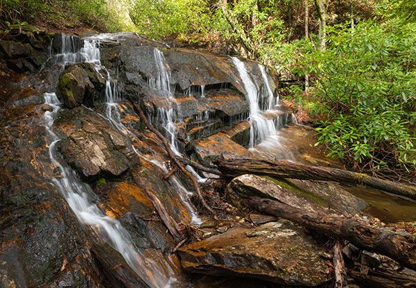
Waterfall 1 in Possum Hollow
!
A beauty rating of 4 is respectable enough, but you probably won’t care to make a special trip just for this one. However, if you combine it with a hike along the entire Haywood Gap Trail (ideally as a shuttle hike), or you add in Waterfall 2 in Possum Hollow, it makes a nice detour for those who don’t mind bushwhacking.
(101Z15-270277)
Driving Directions
Open driving directions in map appThe trailhead is at Haywood Gap at Milepost 426.5 on Blue Ridge Parkway. The gap is about 3.3 miles south of Beech Gap, where NC 215 goes under the parkway.
Hiking Directions
Quick Glance
Walk a few yards northeast from the parkway and turn left at the trail junction. Follow the trail down to the first creek coming in on the left. Climb the river-left bank of the creek and follow the narrow path nearly to the falls, then bushwhack the rest of the way.
Detailed Look
Mountains -to-Sea Trail crosses Blue Ridge Parkway at Haywood Gap. Follow the trail on the northeast side of the parkway. (Right side of road if you’re traveling south from Beech Gap.) In 200 feet you’ll come to a trail junction. MST goes to the right. Turn left on Haywood Gap Trail.
You’ll soon enter Middle Prong Wilderness. After hiking for about three quarters of a mile, you’ll come to a creek crossing below a small waterfall. Cross the creek and climb up the river-left bank. You should be able to pick up a makeshift path that follows the creek upstream. The path takes you close to the falls and you’ll need to bushwhack the rest of the way.
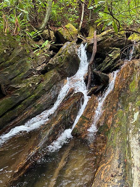
The little waterfall where Haywood Gap Trail crosses the unnamed tributary. (270283)
| Accessibility: | Hiking trail and bushwhack |
| County: | Haywood |
| River Basin: | French Broad |
| Watercourse: | Tributary of Haywood Gap Stream |
| Watershed: | Small |
| Type and Height: | 23-foot, steep, cascading falls Height measured with rangefinder. |
| Landowner: | Pisgah NF, Pisgah RD |
| Beauty Rating: | 4 |
| Elevation: | 4760 feet |
| USGS Map: | Sam Knob |
| Hike Difficulty: | Moderate/difficult |
| Hike Distance: | Approx. 0.9 miles |
| Waterfall GPS: | 35.3213, -82.950465 |
| Trailhead GPS: | 35.31358, -82.95394 |