
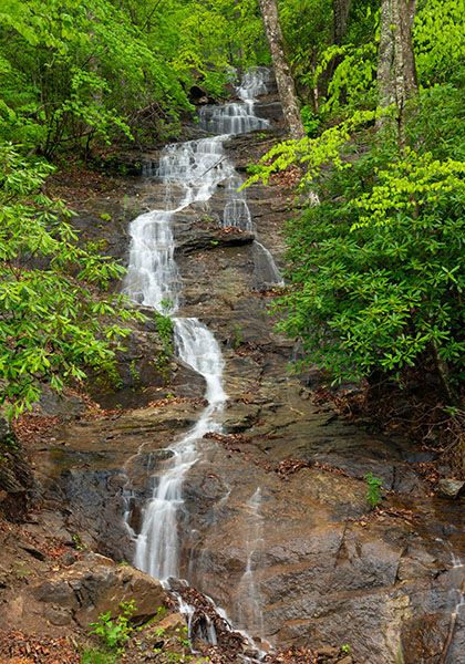
Waterfall 1 on tributary to Cane River
!
Like other waterfalls of its type, this one has a Jekyll and Hyde personality. If you visit during wet weather, it looks very nice. If it hasn’t rained in a while, you’ll question why I’m giving it space on this website.
The good thing is that you don’t have to exert any effort to find out whether you’re getting Jekyll or Hyde. You don’t even have to get out of your car!
(070Z14-270299)
Driving Directions
Open driving directions in map appFrom US 19E in Burnsville, get on NC 197 heading south and set your odometer to 0. In the community of Murchison, NC 197 turns right and crosses Cane River. Don't turn right. Continue straight on what is now Ewart Wilson Road. In about 12.1 miles from US 19E, you’ll reach the falls on the left. A narrow gravel pullout is on the right, beside Cane River
The trailhead for Falling Water Branch Falls is less than 0.1 miles farther along the road.
Hiking Directions
Quick Glance
Look out your window.
Detailed Look
Roll down your window and look out.
| Accessibility: | Roadside view |
| County: | Yancey |
| River Basin: | French Broad |
| Watercourse: | Tributary to Cane River |
| Watershed: | Very small |
| Type and Height: | Steep, cascading falls, about 130 feet high Height measured with rangefinder. |
| Landowner: | Mount Mitchell State Park |
| Beauty Rating: | 1-4, based on flow |
| Elevation: | 3190 feet |
| USGS Map: | Mount Mitchell |
| Hike Difficulty: | View roadside |
| Hike Distance: | View roadside |
| Waterfall GPS: | 35.808071, -82.312927 |
| Parking GPS: | 35.808071, -82.312927 |