Hendersonville Reservoir Dam
!
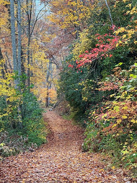
Here’s a nice outing when you want to get a little exercise and see some nice things but don’t want to push too hard. The entire hike is along an old forest road that passes by a little waterfall (Waterfall on Long Branch) on the way to the reservoir. The distance is enough to make you feel like you’ve accomplished something but not enough to wear you out.
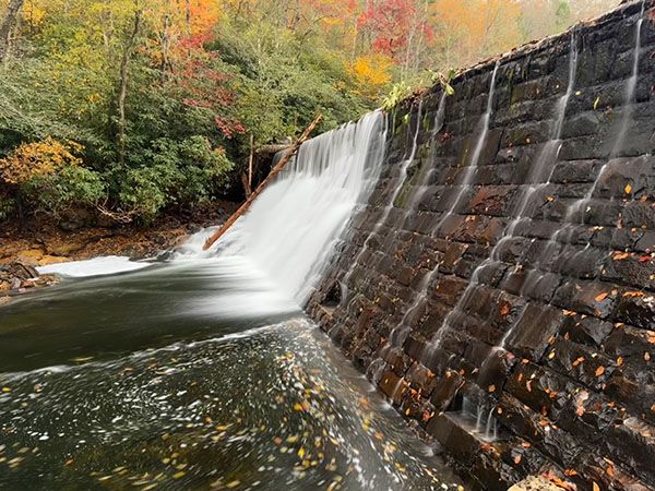
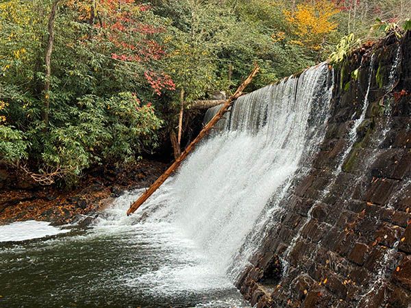
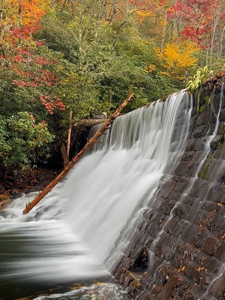
The dam and reservoir are very scenic, and there’s even a small waterfall falling directly into the reservoir (Waterfall 1 on Fletcher Creek).
Bee Branch Falls and Upper Bee Branch Falls can be accessed by hiking Big Creek Trail upstream from the reservoir to Bee Branch.
The reservoir serves as a backup water supply for the city of Hendersonville.
(065Z36-257471)
Driving Directions
Open driving directions in map appFrom NC 280 in Mills River, turn on North Mills River Road and drive 4.9 miles to FS 5000 (Wash Creek Road) on the right, at North Mills River Recreation Area. Follow FS 5000 for 2.0 miles (becomes unpaved at 0.3 miles) and take the left fork onto FS 142. Drive 0.5 miles to Trace Ridge Trailhead at the end of the road.
Hiking Directions
Quick Glance
Follow FS 142 beyond the gate to the dam.
Detailed Look
Two gated forest roads, close together, begin from the trailhead. FS 5097 is on the right and the continuation of FS 142 is to the left. FS 142 takes you to the dam. Along the way you’ll pass by Waterfall on Long Branch.
| Accessibility: | Forest road |
| County: | Henderson |
| River Basin: | French Broad |
| Watercourse: | Big Creek and Fletcher Creek |
| Watershed: | Medium |
| Type and Height: | Approx. 15 feet high Height measured with rangefinder. |
| Landowner: | Pisgah NF, Pisgah RD |
| Experience Rating: | Good |
| Elevation: | — |
| USGS Map: | Dunsmore Mountain |
| Hike Difficulty: | Moderate |
| Hike Distance: | 1.6 miles |
| Waterfall GPS: | 35.419714, -82.675469 |
| Trailhead GPS: | 35.42028, -82.65683 |
Photo Gallery
Click a photo to enlarge.