
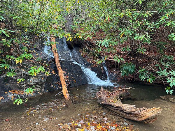
Waterfall on Long Branch
!
This is not a waterfall you’d make a lot of effort to see, but you pass right by it on the hike to other waterfalls, so you might as well stop for a look.
The trail to this waterfall is the access for Hendersonville Reservoir Dam, Waterfall 1 on Fletcher Creek, Bee Branch Falls, and Upper Bee Branch Falls.
(065Z37-257431)
Driving Directions
Open driving directions in map appFrom NC 280 in Mills River, turn on North Mills River Road and drive 4.9 miles to FS 5000 (Wash Creek Road) on the right, at North Mills River Recreation Area. Follow FS 5000 for 2.0 miles (becomes unpaved at 0.3 miles) and take the left fork onto FS 142. Drive 0.5 miles to Trace Ridge Trailhead at the end of the road.
Hiking Directions
Quick Glance
Follow FS 142 beyond the gate to the falls.
Detailed Look
Two gated forest roads, close together, begin from the trailhead. FS 5097 is on the right and the continuation of FS 142 is to the left. FS 142 takes you to the falls in 1 mile.
| Accessibility: | Forest road |
| County: | Henderson |
| River Basin: | French Broad |
| Watercourse: | Long Branch (Tributary of North Fork Mills River) |
| Watershed: | Very small |
| Type and Height: | Perhaps 25 feet high Height estimated. Rhododendron block the upper portion from view. |
| Landowner: | Pisgah NF, Pisgah RD |
| Beauty Rating: | 2 |
| Elevation: | 2440 feet |
| USGS Map: | Dunsmore Mountain |
| Hike Difficulty: | Moderate |
| Hike Distance: | 1 mile |
| Waterfall GPS: | 35.425048, -82.669757 |
| Trailhead GPS: | 35.42028, -82.65683 |